Geographies
Updated 6/10/2025
Jump to:
UK geographies
When using data, statistics and information you may find different geographies used. This webpage explains more about the different geographies you may come across.
https://www.ons.gov.uk/methodology/geography
Bolton Geographies
A range of different geographies are used locally. These are in general based on administrative geographies (e.g. lower super output area, middle super output area) and electoral geographies (e.g. ward, constituency). Within the two systems geographies build up from smaller to larger, but between the two systems the boundaries are completely different.
- The July 2024 general election was held on new parliamentary constituency boundaries. The House of Commons Library has produced an interactive tool showing the changes.
- See the Neighbourhoods page of this website for information available at smaller geographies.
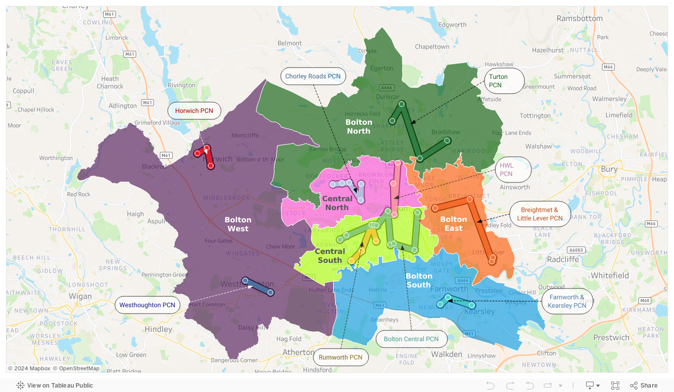
- The map below shows the main geographies used locally: wards, integrated health and social care neighbourhoods, middle super output areas (MSOAs) and lower super output areas (LSOAs). GP practices and the neighbourhood they are affiliated to are shown as points.
- To change what's shown on the map use the layer control (looks like a stack of paper) to turn on and off the different geographies.
View this map in a seperate tab
Integrated care neighbourhoods
Neighbourhoods are a local geography for integrated health and social care; all have a population of around 50,000 residents. See the Neighbourhoods page of this website for information available at smaller geographies, including integrated care neighbourhoods.
Bolton's Neighbourhoods are built up of Lower Super Output Areas (LSOAs, a small administrative geogroaphy). There is evidence that configuring neighbourhoods with populations of 30,000-50,000 ensures a good understanding and connection to communities, whilst being large enough to support functioning multi-disciplinary and multi-agency team working.
Download files for your own use
- General purpose local lookups and boundaries. Includes a Bolton postcode lookup (giving geographical location of postcodes and which geographies they fall within), and a range of local boundary files in a variety of file formats. These are Bolton-specific cuts of national files, originally from ONS Open Geography portal
- Neighbourhoods lookups and boundaries - these files are associated with integrated care neighbourhoods, a local geography for integrated health and social care built up from Lower Super Output Areas (LSOAs, a small administrative geogroaphy).